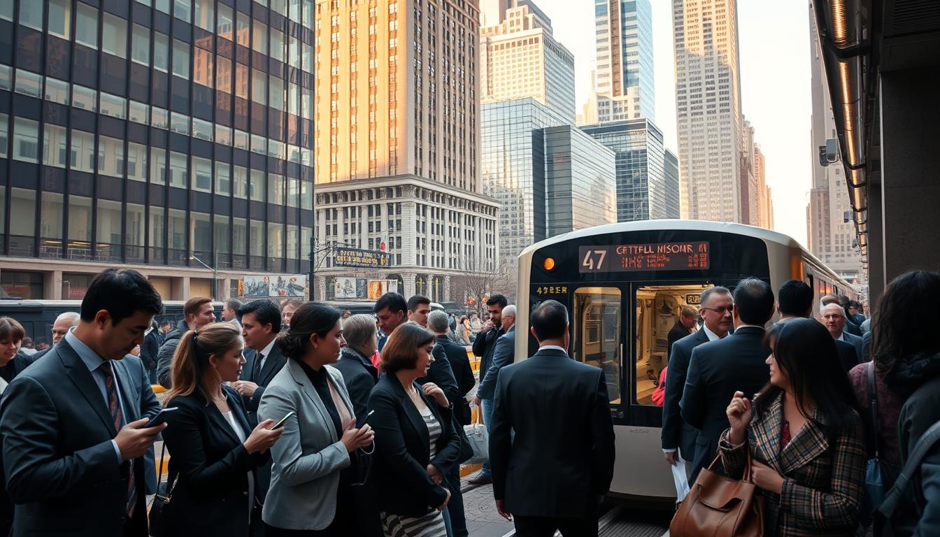
Does Chicago Have A Subway
The short answer is yes. The city’s rapid transit system is the CTA “L,” and it includes both elevated lines and underground tunnels in the downtown area.
This guide shows how to plan trips without a car. You’ll learn which lines to take, how to pay with Ventra, typical train frequency, and how to connect to buses when stations are not nearby.
Expect to see tunnels downtown and elevated track in many neighborhoods. That mix is why locals often say “L” instead of the subway. Downtown acts as the main transfer hub, so route planning starts with your origin and destination.
Practical takeaways include which line serves the airport, how real-time tracking helps, and tips for smooth transfers to regional rail. Using CTA tools and Ventra for fares makes getting around chicago faster and more reliable.
Does Chicago Have A Subway, or Is It the “L”?
The city’s rail network mixes underground tunnels and elevated sections, which causes naming confusion.
Locals often call the whole system the “L” because that name comes from “elevated.” Still, the term subway is used when referring to the downtown tunnels and other below-grade segments. Both labels describe parts of one integrated rapid transit network.
What subway means here
In local usage, subway usually points to sections under the central business district. Visitors will notice trains drop below street level near the Loop and major downtown stops.
Why it’s called the “L” and where it runs underground
The “L” label reflects elevated track that threads many neighborhoods. If your trip leaves the central area, you will often ride above streets on steel structures. If you stay downtown, expect more underground travel.
- The network is one system with multiple lines and shared stations.
- Maps may say “Chicago subway” or “L”—both can be correct depending on the segment.
- Plan trips by thinking rail first, underground vs elevated second.
| Type | Where you’ll see it | What riders notice |
|---|---|---|
| Elevated | Many neighborhood corridors | Open-air views, above-street platforms |
| Subway (underground) | Downtown Loop and central tunnels | Subterranean stations, direct downtown access |
| Mixed / At-grade | Outer segments and connecting stretches | Street-level crossings, quieter zones |
For an official overview of the system and its history, see the Chicago “L” overview. Understanding these basics makes using the CTA operator easier—next we’ll cover lines, stations, and how often trains run.
Meet the Chicago Transit Authority System at a Glance
The chicago transit authority runs the rail and bus network that links most neighborhoods and attractions. The system is easy to follow thanks to color-coded lines and clear maps.
Eight rail lines serve roughly 145–146 stations across the city. Two lines (Red and Blue) operate 24/7. During daytime, trains often come about every 15 minutes.
Late-night “owl service” means fewer trains, usually closer to every 30 minutes where offered. Plan extra time for late trips and check schedules for overnight patterns.
CTA buses cover more than 120 routes and stop every few blocks. A cta bus can fill the last mile, cut walking time, and serve as an alternative during rail disruptions.
| Network | Count | Key note |
|---|---|---|
| Rail lines | 8 color-coded | ~145–146 stations citywide |
| 24/7 lines | 2 (Red, Blue) | Continuous service to core areas |
| Bus routes | 120+ | Stops every few blocks for last-mile coverage |
| Typical frequency | Day ~15 min / Night ~30 min | Adjust plans for owl service |
How to Plan Your Route Throughout the City
Before you open an app, decide whether your trip starts downtown, in a neighborhood, or at an airport. That single choice shapes which routes and transportation options will save you time.
Choose your start and end points
Identify exact addresses or stations first. If you begin in the downtown area, transfers often happen inside the Loop and walk times shrink.
Use CTA maps and the Ventra app
Read color-coded lines on CTA maps to spot transfer stations. Use the Ventra app to check real-time arrivals and reload balances so you avoid waits.
Know the Loop and time budgeting
The Loop is the hub where many lines meet. When planning, weigh fewer transfers versus shorter total travel time.
- Estimate platform-to-platform time.
- Add transfer time (usually 5–10 minutes).
- Include a last-mile cushion in minutes for walking or bus hops.
| Step | What to check | Why it matters |
|---|---|---|
| Origin & destination | Downtown, neighborhood, or airport | Determines best lines and transfers |
| Realtime tools | Ventra app and CTA arrivals | Reduce wait times and missed connections |
| Time budget | Platform + transfer + last mile | Keeps trips predictable in minutes |
How to Pay Fare on Chicago Transit
 fare card being swiped at a turnstile, with a blurred background showing a bustling subway station. In the foreground, emphasize the metallic turnstile and the colorful fare card held by a person in professional business attire, showcasing a focused expression. The mid-ground captures the movement of commuters, with diverse individuals including professionals and families, dressed in smart casual clothing. The background features iconic elements like tiled walls, signage, and a hint of train tracks, bathed in warm, ambient lighting. The overall mood conveys a sense of connectivity and movement, highlighting the efficiency of the transit system.")
Choose the right payment method before you tap in and start your trip. That saves time and reduces stress while you move around the city.
Ventra Card vs Ventra Ticket
Ventra Card is reloadable and works well for repeat travel. Use it if you expect multiple rides or need flexible reloading.
Ventra Ticket is a disposable paper option from station vending machines. It suits short stays or single-day visitors who want a simple payment.
Contactless and mobile tap-to-pay
Ventra readers accept Apple Pay and Google Pay. Tap your phone or contactless card at station gates and bus readers for quick access.
Cash rules and where to buy
Cash is accepted on buses but not for train gates. Buy tickets or reload cards at Ventra vending machines in every L station or many retail outlets.
Passes and reduced options
Day passes and multi-day passes simplify budgeting for sightseeing. CTA trains cost $2.50 per ride, buses are $2.25, and the Blue Line trip from O’Hare is $5.
Reduced Fare and Free Ride programs exist for eligible riders. Check eligibility and program details on the official paying-for-your-ride page: paying for your ride.
| Product | Best for | Where to buy |
|---|---|---|
| Ventra Card | Frequent visitors, reload flexibility | Vending machines, retailers |
| Ventra Ticket | Short visits, single use | Station vending machines |
| Contactless pay | Short stays, quick taps | Ventra readers at gates and on buses |
Which Train Line Should You Ride?
Choosing the right line starts with where you are staying, whether you need round‑the‑clock service, and if you must reach an airport or suburb. Use these quick notes to match destinations and service patterns.
Red Line: steady 24/7 spine
The red line runs all day and night through downtown and connects the North Side to the chicago south side. It often serves as the most direct spine for many trips and offers frequent service.
Blue Line: direct airport rapid transit
The blue line is also 24/7 and gives direct access to O’Hare International Airport. Expect about 40 minutes from O’Hare to downtown under normal conditions. This line doubles as reliable rapid transit for west‑side travel.
Orange Line and Purple Line notes
The orange line is the go‑to for Midway; the ride to the Loop takes roughly 25 minutes on most runs. For suburban and North Shore trips, the purple line serves Evanston and offers rush‑hour express service toward downtown.
Brown, Green, Pink and Yellow guidance
The brown line links North Side neighborhoods to downtown. The green line heads to key West and South Side destinations. Use the pink line for connections near Cicero and the yellow line for Skokie links; both pair well with other routes to reach the core.
- Pick by location, 24/7 needs, or airport connection.
- Check schedules when planning transfer time in minutes.
- Remember color names make navigation simple across lines.
| Line | Best use | Typical time to downtown |
|---|---|---|
| Red Line | North/South spine | Varies — frequent 24/7 service |
| Blue Line | O’Hare to downtown rapid transit | ~40 minutes |
| Orange Line | Midway to Loop | ~25 minutes |
| Purple/Brown/Green | Suburbs / neighborhood links | Short to moderate, depends on transfers |
Getting to Downtown Chicago and the Loop Without a Car
Arriving in the Loop without driving is simple when you choose the right rail or bus route and plan one smart transfer. The Loop is the downtown rail hub, so many options end there or within easy walking distance.
Finding the right station and transfer points once you’re in the downtown area
Use CTA lines, buses, or regional rail to reach Loop stops. Pick the nearest station to your hotel or office to cut walking time.
Follow posted station names and color signs on platforms. Confirm the correct side of the platform before boarding to avoid backtracking.
Major downtown rail terminals: Union Station, Millennium Station, and LaSalle Street
These terminals matter for visitors from suburbs or other cities. Metra and Amtrak trains arrive at key points that place you steps from Loop transfers.
- Use CTA “L” or buses for short links from terminals into the core.
- Choose the best terminal based on final address and how much you want to walk.
- Stay inside the Loop for quick platform-to-platform transfers; exit and walk if the destination is only a few blocks away.
| Terminal | Serves | Why it matters |
|---|---|---|
| Union Station | Amtrak, Metra | Direct regional service into the city center; easy CTA connections |
| Millennium Station | Metra, near lakefront | Close to Riverwalk and Navy Pier; short walk to Loop lines |
| LaSalle Street Station | Metra | Business district access and quick links to nearby Loop stops |
Many attractions sit within a short walk of Loop stations, so basing yourself downtown chicago makes day trips and sightseeing easier. Expect efficient transfers and frequent stops once you plan where to get off.
How to Ride from the Airports Into the City
Arrivals at O’Hare and Midway connect directly to CTA rail for a predictable trip downtown. Follow airport signs to the CTA or “Rail” and head for the station entrance. Allow extra minutes for luggage, elevators, and ticket purchase.
O’Hare: Blue Line to downtown in about 40 minutes
Board the Blue Line at the airport station and ride toward the Loop. The trip takes roughly 40 minutes to reach major downtown stops. Trains run often and travel is straightforward with few transfers.
Midway: Orange Line to downtown in about 25 minutes
From Midway, follow signs to the Orange Line platform. Expect about 25 minutes to downtown on most runs. This line is usually the fastest rail option from that terminal.
Airport fares and a quick decision rule
Standard CTA fare is $2.50 per ride, but trips from O’Hare carry a $5 charge at the Blue Line gate. Rail is usually cheaper than taxis or rideshare for most downtown trips.
- Follow signs to CTA rail and buy or tap a Ventra fare.
- Confirm train direction toward downtown before boarding.
- Budget extra minutes for luggage, station stairs, and platform navigation.
| Airport | Line | Typical time to downtown |
|---|---|---|
| O’Hare | Blue Line | About 40 minutes — $5 fare |
| Midway | Orange Line | About 25 minutes — $2.50 fare |
| Decision tip | Rail vs rideshare | Rail: cheaper & predictable; rideshare: door-to-door, useful late or with lots of bags |
Once you arrive downtown, local buses and short rides cover last‑mile needs. Use buses for short hops to hotels or neighborhoods that sit between stations.
Using CTA Buses to Fill the Gaps Between Stations

Buses often bridge the gap between rail stops and final destinations, making many trips simpler.
City surface transit runs on frequent corridors with stops about every few blocks and clear posted signs. This pattern helps riders confirm they are in the right place before boarding.
How routes, stops, and times work
Most routes run daily into late evening, and select lines offer owl service about every 30 minutes. Expect variable travel times when traffic or peak periods affect street flow.
Estimate ride distance by counting blocks and adding buffer minutes for congestion. That helps when you compare a direct bus to an extra train transfer.
Transfers, planning, and smart connections
Use the Ventra app to plan transfers and check real-time arrivals. Build in five to ten extra minutes when you must change vehicles to avoid rushing between stops.
Take a bus to shorten a long walk from an L station or to skip an extra rail transfer. For many trips this reduces total travel time and walking distance.
Comfort, bike racks, and accessibility
CTA buses include front-mounted bike racks and space for mobility devices. Accessibility features and low-floor boarding make short neighborhood hops easier for most riders.
| Feature | What to expect | When to use |
|---|---|---|
| Stops | Every few blocks with posted signage | Short walks and precise drop-off points |
| Service | Daytime frequent runs; select owl service at night | Use at off-peak to extend rail coverage |
| Bike & accessibility | Front racks, low-floor boarding, secure space | Combine cycling and transit for last-mile distance |
| Planning tools | Ventra app and real-time arrival screens | Reduce wait times and time your ride |
Getting Around Chicago Neighborhoods by Train
Start by picking the neighborhood you want to explore, then match trains or rail lines that put you closest to it.
North side picks
Lakeview is easiest via Belmont (Red/Brown). Lincoln Park links well at Fullerton (Red/Brown/Purple). Edgewater is served by Red Line stops like Thorndale and Granville. Ravenswood riders often use the Brown Line or Metra UP-N for quick access.
Near-downtown favorites
River North sits near Grand (Red) and Merchandise Mart (Brown), so short rides and quick returns to downtown are simple. Printers Row is close to Harrison (Red/Green) and LaSalle (Blue), ideal for walkers who want short platform-to-destination time.
South side routes
Hyde Park and South Shore rely more on Metra Electric and regional buses. Choose rail or train based on schedule; Metra can be faster for some South Side trips while CTA fills local gaps.
- Neighborhood-first: pick destination, then the most direct rail or train route.
- Confirm cross streets after exit and use the grid to orient yourself.
- Ride in well-lit areas, check service alerts, and use real-time tracking to avoid long waits.
| Neighborhood | Best station(s) | Notes |
|---|---|---|
| Lakeview | Belmont (Red/Brown) | Frequent north-side service |
| River North | Grand / Merchandise Mart | Short walk to downtown attractions |
| Hyde Park | Metra Electric stations | Use regional rail for schedule-sensitive trips |
Beyond City Limits: Metra, Pace, and Amtrak Options
When your trip leaves the urban core, commuter rail and suburban buses become the faster choice. These regional options cut down transfers and reach places CTA does not.
Metra commuter rail serves suburbs into downtown with 11 routes, 200+ stations, and coverage across roughly 3,700 square miles. Metra is the go‑to for suburb-to‑downtown trips and tickets can often be purchased through the Ventra app for easy transfers into the city.
Pace buses operate across 274 municipalities. Pace works best for suburb‑to‑suburb travel or for areas without nearby Metra stations. Many Pace routes link directly to CTA and Metra hubs, simplifying last‑mile connections.
Amtrak runs regional and cross‑country service from Union Station. Use Amtrak for intercity travel and then switch to local transit for getting around downtown and nearby neighborhoods.
South Shore Line (NICTD) connects Indiana destinations to Millennium Station, providing a direct rail link into the downtown core for travelers from the east.
- Graduate from CTA when your route spans many miles or multiple suburbs.
- Pick the regional mode first (Metra/Pace/Amtrak/South Shore), then plan the final segment using CTA for getting around Chicago.
| Mode | Best use | Key fact |
|---|---|---|
| Metra | Suburb → downtown commutes | 11 routes, 200+ stations, ~3,700 sq miles |
| Pace | Suburb-to-suburb and feeder buses | Serves 274 municipalities, links with CTA/Metra |
| Amtrak / South Shore | Regional & state-to-state travel | Amtrak at Union Station; South Shore to Millennium Station |
Other Transportation Options When Public Transit Isn’t the Best Fit
For tight schedules, heavy bags, or bad weather, pick from walking, bikes, water taxis, or on-demand car services. Each option fills gaps when regular transit does not match your plan.
Walking and the downtown Pedway
Chicago’s grid centers on State & Madison. Count roughly eight blocks per mile to estimate walking distance quickly.
The Pedway links more than 40 blocks across roughly five miles in the central business district. Use it for indoor walks when weather or crowds make surface travel slow.
Divvy, bike lanes, and scooters
Divvy runs about 950 stations and 17,000 bikes and e-bikes. The city also offers 450+ miles of bike lanes, so micromobility is ideal for short hops under two miles.
Taxis, rideshare, and water taxis
Taxi apps like ARRO and Curb accept cards and offer quick pickups. Rideshare gives door-to-door convenience when time is tight.
Water taxis link spots such as Museum Campus, Navy Pier, and Union Station for a scenic route through the downtown area.
Driving and parking tools
When you must use a car, expect traffic delays around chicago during peak times. Use ParkChicago for meter payments and reserve garages with SpotHero, Parking.com, or Millennium Garages to reduce stress.
- Choose alternatives when luggage, late-night gaps, or strict timing make transit impractical.
- Mix walking, Divvy, and short rides to move efficiently around chicago without needing long car trips.
| Option | Best for | Key fact |
|---|---|---|
| Walking / Pedway | Short downtown trips, bad weather | Pedway spans ~5 miles and 40+ blocks |
| Divvy / scooters | Quick trips under 2 miles | 950+ stations; 17,000 bikes and e-bikes |
| Taxi / rideshare | Door-to-door, late-night | App hailing; card payments accepted |
| Driving | Remote destinations, lots of luggage | Use ParkChicago and reservation apps to book parking |
Your Next Ride, Simplified: Put This Chicago Transit Guide to Work Today
Put this short checklist to work and you’ll find getting where you need to go faster and less stressful.
The chicago transit authority runs the rail and bus system that links most neighborhoods. The system combines underground segments and elevated lines, and it’s the backbone for getting around chicago without a car.
Quick action plan: pick your route, confirm train direction, check times in Ventra, and pick the best stations for your stop. Remember Red and Blue run 24/7; owl service can change late-night frequency, and buses fill gaps between stops.
Smart pay tip: choose the right Ventra product, consider a day pass for heavy sight-seeing, and note that cash works on the bus but not at train gates.
Final checklist: start downtown if unsure, plan Loop transfers, and keep a backup (bus, walk, rideshare). Now open a CTA map, set one practice trip, and use this guide as your go-to public transportation reference.